Time Difference: EST + 4 hours Current Time and Date in Senegal
Currency: Currency Converter – CFA Franc XOF
Travel Advisory: State Department Report Senegal
US Embassy in Senegal: dakar.usembassy.gov
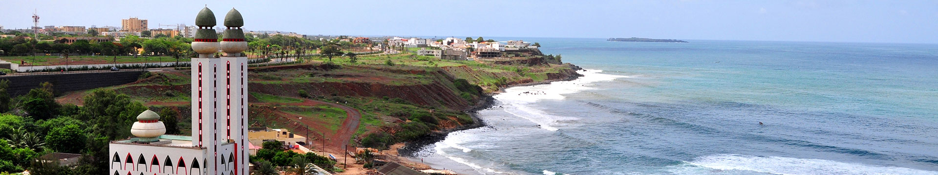
Republic of Senegal is a country in West Africa. It owes its name to the Sénégal River that borders it to the east and north. Senegal is externally bounded by the Atlantic Ocean to the west, Mauritania to the north, Mali to the east, and Guinea and Guinea-Bissau to the south; internally it almost completely surrounds the Gambia, namely on the north, east and south, except for Gambia’s short Atlantic coastline. Senegal covers a land area of almost 197,000 square kilometers (76,000 sq mi), and has an estimated population of about 13 million. The climate is tropical with two seasons: the dry season and the rainy season.
Health: CDC Senegal
What to Pack
Weather: Senegal Weather
Communications: Dial 011 followed by country code 221
Travel Requirements
- Passport
- Visa required for all US Passport Holders, If you are not a US Passport holder, please consult the embassy in your region.
- Proof of Immunization (Yellow Fever)
Diplomatic Missions
Embassy of Senegal
Embassy of Senegal in Washington, DC.
Embassy of Senegal in Paris
Embassy of Senegal in France
Embassy of Senegal in London
Embassy of Senegal in England
CLIMATE
Warm season: February 23 to May 22 average daily high temperature above 97°F.
Cold season: July 9 to September 24 average daily high temperature below 91°F.
Language: French is the official language; English is widely spoken.
PLACES OF INTEREST
Bassari Country: Bassari, Fula and Bedik Cultural Landscapes
The site, located in south-east Senegal, includes three geographical areas: the Bassari–Salémata area, the Bedik–Bandafassi area and the Fula–Dindéfello area, each with its specific morphological traits. The Bassari, Fula and Bedik peoples settled from the 11th to the 19th centuries and developed specific cultures and habitats symbiotic with their surrounding natural environment. The Bassari landscape is marked by terraces and rice paddies, interspersed with villages, hamlets and archaeological sites. The Bedik villages are formed by dense groups of huts with steep thatched roofs. Their inhabitants’ cultural expressions are characterized by original traits of agro-pastoral, social, ritual and spiritual practices, which represent an original response to environmental constraints and human pressures. The site is a well-preserved multicultural landscape housing original and still vibrant local cultures.
Island of Gorée
The island of Gorée lies off the coast of Senegal, opposite Dakar. From the 15th to the 19th century, it was the largest slave-trading centre on the African coast. Ruled in succession by the Portuguese, Dutch, English and French, its architecture is characterized by the contrast between the grim slave-quarters and the elegant houses of the slave traders. Today it continues to serve as a reminder of human exploitation and as a sanctuary for reconciliation.
Island of Saint-Louis
Founded as a French colonial settlement in the 17th century, Saint-Louis was urbanised in the mid-19th century. It was the capital of Senegal from 1872 to 1957 and played an important cultural and economic role in the whole of West Africa. The location of the town on an island at the mouth of the Senegal River, its regular town plan, the system of quays, and the characteristic colonial architecture give Saint-Louis its distinctive appearance and identity.
Djoudj National Bird Sanctuary
Situated in the Senegal River delta, the Djoudj Sanctuary is a wetland of 16,000 ha, comprising a large lake surrounded by streams, ponds and backwaters. It forms a living but fragile sanctuary for some 1.5 million birds, such as the white pelican, the purple heron, the African spoonbill, the great egret and the cormorant.
Stone Circles of Senegambia
The site consists of four large groups of stone circles that represent an extraordinary concentration of over 1,000 monuments in a band 100 km wide along some 350 km of the River Gambia. The four groups, Sine Ngayène, Wanar, Wassu and Kerbatch, cover 93 stone circles and numerous tumuli, burial mounds, some of which have been excavated to reveal material that suggest dates between 3rd century BC and 16th century AD. Together the stone circles of laterite pillars and their associated burial mounds present a vast sacred landscape created over more than 1,500 years. It reflects a prosperous, highly organized and lasting society.